Michinoku Coastal Trail

The Michinoku Coastal Trail is a path for enjoying walking that stretches over 1,000 kilometers from Kabushima in Hachinohe city, Aomori prefecture to Matsukawaura in Soma city, Fukushima prefecture. It was created with the aim of promoting coexistence between nature and humans, raising awareness of environmental issues, and passing on the memory of the Great East Japan Earthquake that occurred in 2011.

This route travels along the Pacific coastline and was fully opened in June 2019.
It's a very long road to walk the whole way, but there are many attractions, such as the most beautiful cliffs in Japan, the unique scenery of a ria coast, and one of the world's three largest fishing grounds, providing a rare and unforgettable experience.


Symbol mark fo Michinoku Coastal Trail

In addition to selling route maps, the NPO Michinoku Trail Club's website, information center, and visitor center will be providing information on route changes due to construction, etc., so please gather information in advance. Please walk with caution and safety.

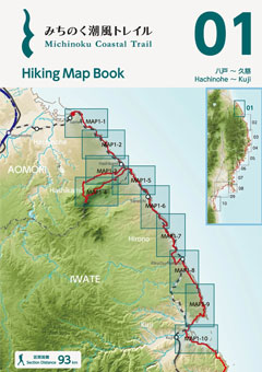
Hiking Map Book

Michinoku Coastal Trail Hiking Map Book 01

NPO Michinoku Trail Club

This is a route map for the Michinoku Sea Breeze Trail.
The entire route (from Hachinohe City, Aomori Prefecture to Soma City, Fukushima Prefecture) is divided into 10 books, with "01" covering the route from Hachinohe City, Aomori Prefecture to Kuji City, Iwate Prefecture. The entire 10-book set is also available for purchase.

Buy at Trail Gate

Attractions around Mount Hashikami

The route of the Michinoku Coastal Trail passes in front of JR Hashikami Station in Hashikami Town, Aomori Prefecture, then heads for the summit of Mt. Hashikami-dake, returning along the coast again from Kominato Fishing Port in Hashikami Town.
Here are some highlights of this section.

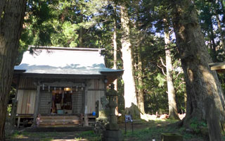
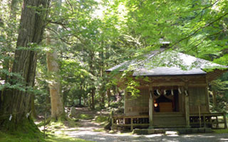
Tate Shrine

This shrine was founded in 1572.
The site of a castle called Dobutsu-date or Ezo-date was a castle with multiple moats and earthworks that cleverly made use of the terrain. The castle fell in 1591 when the Kunohe Masazane Rebellion occurred.
"Tate" or "Date" refers to castles from the time when this area was Ezo, and there were several Tate in the surrounding area.

The fir tree on the grounds is estimated to be 400 years old. It has a trunk circumference of 6.27 meters and a height of 28 meters, making it one of the largest in Aomori Prefecture.


Tate Shrine and Fir Tree

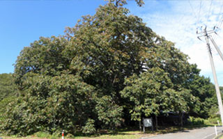
Horse chestnut tree on Barajima

This is a horse chestnut tree near the Barajima Rest Area.
It is said that an ancestor of the Barajima family brought the fruit from Kyoto and planted it in the garden.

It is one of the largest horse chestnut trees in Aomori Prefecture and has been designated a prefectural natural monument.
The tree has a trunk circumference of 6.98 meters, a tree height of 28.5 meters, and an estimated age of 850 years.


Horse chestnut tree on Barajima

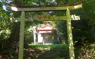
Kumanodo

This shrine is said to have been served by a family with the surname Ito as their guardian deity for over 1,000 years.
It is said that it was a sacred place for the Kumano-devoted Yamabushi, as it enshrines the spirit of the Kumano Sanzan, and the Amida Sanzon is also enshrined on the side.

The Koshin tower in the shrine grounds was built in 1767 and is the oldest in Hashikami town.


Kumanodo

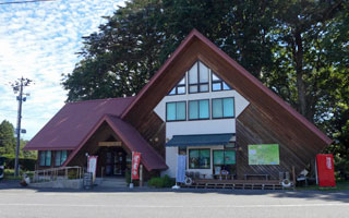
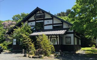
Forest peer Hashikami

This shop is located at the trailhead of Mt. Hashikami and sells local vegetables and processed foods, as well as meals and desserts such as Hashikami-Wase Hashikami-Soba. The gelato is popular.
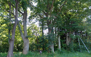
The row of zelkova trees behind the building is known as some of the largest and oldest trees in Hashikami Town.

"Come and take a walk in Hashikami Town!" is a guide map for walking around the town's famous sites created by students from the Hachinohe Institute of Technology. Of the three courses, the "Walking Course of Relaxing at the foot of the mountain " starts and ends at Forestpia Hashikami.
It is a walking course that takes about 90 minutes to walk around the flat road at the foot of Mt. Hashikami, so we also recommend walking this way.


Forest peer Hashikami

Mt. Hashikamidake Trail Head Japanese zelkova Stand

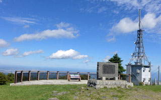
Mount Hashikami-dake summit

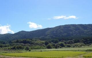
This 739.6-meter peak is the northernmost point of the Kitakami Mountains.
It is a hilly mountain with a gently sloping ridge that rises on a plateau that is one level above the coast, and is also known as "Gagyu-san" because its shape resembles a reclining cow.
A large amount of magma slowly solidified to form the mountain, and another distinctive feature is that the entire mountain is one large rock.

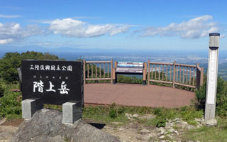
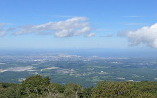
From the summit observation deck, you can see the whole of Hachinohe city, Hashikami town, and the Pacific Ocean. When the weather is good, you can also see Mount Hakkoda and the Shimokita Peninsula in the distance.


Mt. Hashikami-dake

Mountaintop Observatory

View from the observation deck

Ohbiraki-tai

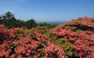
Located at the eighth station of Mt. Hashikami, Ohbiraki-tai is home to a colony of approximately 20,000 natural azaleas, which bloom in bright red flowers every year from late May to early June.


Ohbiraki-tai

Azalea colony
(Photo :Amazing AOMORI)

Terashita Kannon and Ushioyama Shrine

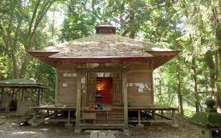
Terashita Kannon is a Kannon hall that originated from Omotsu-ji Temple, which was founded over a period of five years starting in 724. In 1186, Futsunushi no Mikoto was also enshrined here, and it has come to be revered as a sacred place where Shinto and Buddhism are syncretized. It is also the first temple of the Thirty-Three Kannon Temples of Oshu-Nanbu-Nukanobu, which stretches from Aomori to Iwate prefectures.

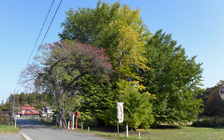
The main building of Shioyama Shrine is the former Kannon Hall, built in 1626, and the ginko tree nearby is estimated to be 800 years old. The tree has a trunk circumference of 10.1 meters and a tree height of 23 meters.
In addition, the area around Terashita Kannon and Shioyama Shrine is also home to the Terashita Kannon Japanese Wisteria, Terashita Metasequoia, and Dragon God Pine, which are registered as giant and ancient trees in Hashikami Town.


Terashita Kannon

Ushioyama Shrine and Ginko tree

Ushioyama Shrine Ginko biloba

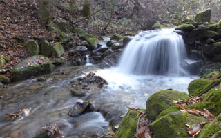
Terashita Falls

Soba restaurant Toumon

This restaurant, located in front of Terashita Kannon and Shioyama Shrine, serves "Hashikami-Wase Hashikami-Soba".
Jazz concerts by professional musicians are also held irregularly.

Additionally, "Come and take a Walk in Hashikami Town", a guide map for walking around the town's famous sites created by students from the Hachinohe Institute of Technology, has three courses; one of which, the "Walking course of Prayer", starts and ends at Toumon.
This is also recommended, as it is a 60-minute walking course that goes around the grounds of Terashita Kannon and Ushioyama Shrine, as well as the surrounding area, including the remains of the Tomyodo Hall. There are some slopes, so trekking equipment is recommended.


Soba restaurant Toumon

Inside a restaurant

Hashikami-Wase Hashikami-Soba

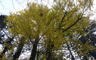
Ichokikubo Giant Ginko biloba

This is one of the largest ginko trees in Aomori Prefecture and is designated as a prefectural natural monument.
It is said to be the oldest tree in Hashikami-cho, and is estimated to be 1,000 years old.
Many aerial roots hang down from the branches, and because they resemble breasts, local people call it the "Great Ginkgo with Hanging Breast Roots".


Ichokikubo Giant biloba